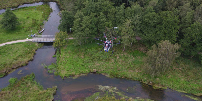
DTU will be heading a new project, where drones and new technological measuring methods will make the monitoring of Danish watercourses more detailed and precise, something which is increasingly in demand. The current climate change means, for example, that updated knowledge about the capacity of our watercourses is required to be able to assess whether they can serve as drains in connection with cloudbursts, or whether there is a risk of flooding.
Today, watercourses are monitored using manual measurements, so the possibility of being able to perform better measurements in future using drones will also result in considerable cost reductions.
The drone will be equipped with special sensors and instruments, both cameras and high-tech radar and sonar instruments. Together, they can provide measurements of both water depth, vegetation, water flow, and water level in the individual watercourses.
Highly detailed and accurate data
“Thanks to the new combination of sensors, our measurements will provide authorities and environmental advisers with far more detailed and precise data than has previously been possible. We will be able to measure water levels with a precision of 3-5 cm, and to provide high-resolution maps indicating vegetation and water weeds in and near the watercourse. This allows the municipalities to assess when and—in particular—where watercourse maintenance intervention is required, and how to intervene in terms of climate proofing,” says Professor Peter Bauer-Gottwein, DTU Environment, who is heading up the new project.
In this project, DTU Space will further develop existing payloads from the prototype stage to market products.
Improved decision-making basis for authorities
In light of the project goal of being able to offer the authorities a better and more correct decision-making basis, it has been natural to also include regions and municipalities in the three regions of Denmark, where the first drone measurements will be performed: the Vejle Å river and the Grindsted Å river in Jutland as well as the Mølleåen river in the Greater Copenhagen area.
“As future end-users, it’s very relevant for us to collaborate with both researchers and business on solving the challenges that arise during the project. This is the best way of ensuring that the end result will be adapted to our reality and our needs. In the regions, for example, we need to keep an eye on whether contaminated sites pose a threat to the water quality of watercourses, which places special demands on the watercourse monitoring data,” says Nina Tuxen, Chief Consultant, Capital Region of Denmark.
She adds that the region is always interested in projects that open up for new export opportunities and new jobs, irrespective of whether it is within advisory services or technology.
Drones will give more precise information for monitoring watercourses and thus better climate proofing. Innovation Fund Denmark has invested DKK 7,955,000 (EUR 1 million) in the project.
Source: TECHNICAL UNIVERSITY OF DENMARK
